|
INTRODUCTION
Kenya is located on the equator on the continent's east coast.
The country is well known for its scenic beauty and varied
wildlife. Although only about 20 percent of the land is suitable
for cultivation, the majority of Kenyans are farmers who produce
crops mainly for their own needs. Coffee and tea, grown for
export on large plantations and on small farms, together with
tourism are Kenya's most important sources of foreign exchange--money
used to buy foreign goods.
CLIMATE AND GEOGRAPHIC REGIONS
Kenya has two wet seasons and two dry seasons. The rainy seasons
extend from March to May and from November to January. The
amount of rainfall is greatest in the highlands of Kenya,
which are located in the west. The lowland deserts of the
north receive the least amount of rain. Occasionally the rains
fail or are below normal for consecutive seasons, leading
to drought.
Because of the uneven distribution of rainfall
and the variation in land elevation, ecological conditions
differ throughout the country. However, three main geographic
zones have been determined to exist: the highlands, the semiarid
lowlands, and the deserts. A fourth, called the coastal zone,
occupies a narrow strip along the Indian Ocean.
CURRENT NAIROBI WEATHER
Enter a City or US Zip:
THE HIGHLANDS
In the western part of Kenya the land rises to more than 5,000
feet (1,500 meters) above sea level. These highlands, which
represent less than 25 percent of Kenya's land area, are divided
by the Great Rift Valley. In the eastern part of this region,
Kenya reaches its highest point at the peak of Mount Kenya,
17,058 feet (5,199 meters) high. The highlands are the only
part of the country where rainfall is sufficient--over 50
inches (1,270 millimeters) a year--and reliable enough to
support farming. Because most Kenyans depend on agriculture
for a living, it is in these highlands that the majority of
the population lives. Most of the forest that once covered
the land has been cleared for crop production. Some of Kenya's
forest does remain, and national parks have been created by
the government to protect the local vegetation and the wildlife.
The semiarid lowlands. Much of Kenya is semiarid,
receiving between 15 and 30 inches (380 and 760 millimeters)
of rainfall a year. This amount of rainfall is insufficient
for production of crops, so cultivation is limited to the
borders of rivers and swamps where irrigation is possible.
In the past there was little farming in the lowlands, and
most of the inhabitants were nomadic or seminomadic herders.
The number of lowland farmers has increased, however, as people
have moved from the overcrowded highlands in search of land.
The main economic activities are livestock
raising by Kenyans and wildlife viewing by foreign tourists.
Both the wildlife and the livestock are able to graze on the
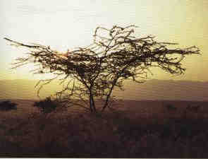
vegetation that grows under the dry conditions. Trees, such
as the acacia, are scattered throughout the bushy grasslands.
The herders, such as the Masai (Maasai), raise cattle, goats,
and sheep and move them seasonally from place to place to
give them access to water and pasture.
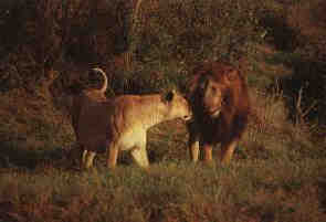
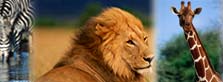
The wildlife includes large numbers of gazelles,
zebras, and wildebeests, and predators such as the lion and
cheetah are also prevalent. Also common are the predatory
leopard and wild dog and other grazing animals such as the
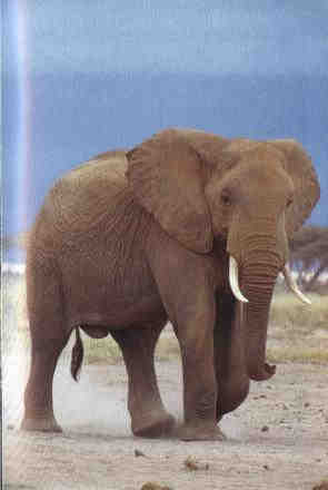
antelope, elephant, buffalo, and rhinoceros. National parks
have been created where these animals and others are found
in large numbers. Unfortunately, water is scarce, and there
is increasing competition for it among the animals.
THE DESERTS
The deserts of Kenya are not so extensive as other deserts
in Africa. They are located in the north of the country. The
vegetation is sparse, consisting of hardy grasses and occasional
bushes. Desert peoples are few, but the area includes some
nomadic people, such as the Somali and the Gabbra, who raise
herds of camels and goats. On the edge of the desert region
is Lake Rudolf (Turkana), which stretches down from the border
with Ethiopia. It is the site of a small fishing industry.
Archaeologists working on the shores of the lake have found
evidence of some of the Earth's earliest people, dating the
ancestors of man back some 4 to 5 million years.
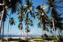
THE COAST
Stretching along the shores of the Indian Ocean is a narrow
strip of land 10 to 15 miles (16 to 24 kilometers) wide that
separates the dry interior from the sea. It is an area with
relatively heavy rainfall, 40 inches (1,000 millimeters) a
year, and is an important crop-producing area. Cash crops
such as coconuts and cashews are produced.
For centuries the coast has been important
in trade across the Indian Ocean, and ancient ports, such
as Lamu, remain as evidence of the early coastal trade cities.
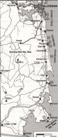
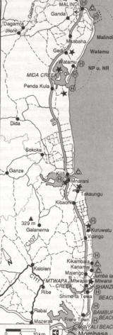
Today, Mombasa is the largest coastal city and Kenya's largest
and busiest port. It has modern facilities, an oil refinery,
and a variety of light industries. The port also serves the
landlocked countries of Uganda, Rwanda, and Burundi. The long
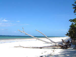
and beautiful white coral sand beaches are the basis of Kenya's
coastal tourist industry. Hotels serve tourists along the
entire length of the coast.
POPULATION AND ECONOMY
Kenya has more than 100 different ethnic groups. This
poses a potential problem of communication. Swahili and English
have been selected as national languages and most people speak
at least one of these as well as their own local language.
The people are also divided among many religious
groups. African traditional religions are widespread as is
Christianity, which was spread by missionary groups in the
19th and early 20th centuries. Islam is particularly well
established along the coast; the Kenyans of Asian origin are
predominantly Hindus.
Kenya's artistic heritage is represented by
a variety of crafts. Among them are matweaving on the coast,
wood carving by the Kamba people, and beadwork jewelry made
by groups such as the Masai and the Samburu.
Among the nation's 28 million people, the most
populous groups are the Kikuyu, the Luhya, the Luo, and the
Kamba. There are just over one million herders such as the
Masai and the Somali living in the semiarid and desert areas.
An increasing number of people live in the capital city of
Nairobi and in other large cities. In the early 1990s it was
estimated that Kenya's population was increasing at the rate
of 3.6 percent a year. This growth rate, one of the world's
highest, greatly increases the people's demand for land, housing,
food, jobs, education, medical care, and other services.These
conditions place a severe strain on the economy of Kenya,
a country whose resources are extremely limited.
One reason that Kenya has remained heavily
dependent on agriculture is its lack of fuel resources, such
as petroleum. Totally reliant on foreign countries for oil,
Kenya's manufacturing industries have developed slowly. Some
energy is forthcoming from hydroelectric projects, but it
is inadequate, and additional electric power must be imported
from neighboring countries. To remedy this situation, especially
in light of oil-price increases, the government has accelerated
development of alternative sources of energy. Kenya now produces
power from geothermal (natural heat from the Earth's interior)
sources, and plans are to increase the number of geothermal
units. The sugar industry, which can produce alcohol for fuel,
is another developing source. The Kenyan economy receives
minimal support from such other resource areas as mining,
forestry, and fisheries.
AGRICULTURE
The most rapidly growing population group in Kenya is the
farmers. In many areas, however, there is insufficient land
available, and some farms have been subdivided into several
units. These are often unable to produce sufficient crops
to meet the needs of the families tending them. Increasing
numbers of people are migrating to areas where more land is
available. Most of the areas where people can find land are
on the dry edges of the highlands. In these areas soils may
be less fertile and the rainfall less certain, making farming
risky.
The vast majority of Kenya's farmers own only
about seven acres (three hectares) of land. On these small
farms most of what they produce is to meet their family's
needs. Some crops are grown for sale to raise money to buy
consumer items. Typically a farmer grows several different
crops together in the same field: a grain such as corn; a
legume such as beans; and perhaps a few trees producing coffee,
bananas, or mangoes. This allows the family to harvest a variety
of foods for a balanced diet. In order to increase production,
the government sponsors agricultural experiments and encourages
farmers to try different production methods. Some farmers
also keep a few animals such as cattle and goats, and many
raise poultry. Tea and coffee, raised for cash and export,
are two of Kenya's major sources of income.
The herders raise such animals as cattle, camels,
sheep, and goats. These produce milk and meat for the family
and some to be sold for cash. Herding families use the cash
to buy grains to supplement the meat and milk in their diet.
As the human population grows so have the number
of animals, and there is concern that they may be overgrazing
the land. In many parts of the country the government is promoting
better use and management of the grazing land.
TOURISM
The other major earner of foreign exchange, the tourist industry,
does not bring income to as many people as coffee or tea sales.
Tourist facilities are concentrated in Nairobi, along the
coast, and in the national parks. The industry is largely
owned by foreign companies, however, and relatively few Kenyans
benefit from it.
Tourists visit Kenya for a number of reasons.
Its beaches are beautiful and uncrowded, and hotels are of
high quality and serve good food. Kenya has one of the world's
largest wildlife populations, and a wide variety of animals
can be seen in national parks. There, excellent hotels with
special viewing facilities have been built for tourists. The
parks protect the wildlife, but some species, such as the
rhinoceros and elephant, are still hunted by poachers for
their horns and tusks. Nairobi also attracts tourists, and
it has become a site for international conferences.
CITIES AND INDUSTRY
The cities of Kenya have been growing partly because of
emigration from the countryside. Most salaried jobs in the
cities are in the government bureaucracy, in industry, and
in occupations such as sales and domestic services.
Kenya's industries include food processing,
brewing, clothing and textiles, transport equipment, and refined
petroleum and petrochemicals. The majority of companies are
located in or near Nairobi, but the government is encouraging
new firms to locate in other towns so that more of the country
can benefit from industry. Nairobi, the capital city of Kenya,
is located on the railway line at the junction between the
lowlands and the highlands. More than 60 percent of Kenya's
salaried workers live in the city, which dominates the nation's
economy. It is an important commercial center and many foreign
firms base their east African operations there. Most government
employees also work in Nairobi.
The Kenyan economy is supported by one of the
best transportation systems in Africa. The railway links the
main towns and paved roads reach all but the most inaccessible
towns. The main roads to Tanzania and Uganda are paved and
the one to Ethiopia is almost completely paved. Nairobi's
modernized airport is one of Africa's busiest. Flights connect
the city to other African cities, and to Europe, the United
States, and Asia.
Education has been strongly supported by the
government and nearly all children go to primary school, which
is free. The adult literacy rate increased from 20 percent
in 1960 to 69 percent in 1990. After primary school the educational
system becomes highly competitive and few of those who go
on to secondary school gain admittance to the University of
Nairobi or any of the country's smaller colleges.
|


 Kenya:
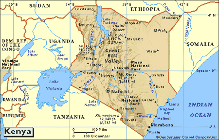

 Earthquake
or Hurrikanes, as you might know it from other exotic destinations,
are unknown in Kenya !
Earthquake
or Hurrikanes, as you might know it from other exotic destinations,
are unknown in Kenya !